QGIS: Free, Open Source Geospatial Mapping
QGIS is a free, open source alternative to the geospatial mapping software ArcGIS Pro. It is compatible with a range of operating systems.
QGIS is a free, open source alternative to the geospatial mapping software ArcGIS Pro. It is compatible with a range of operating systems.

PhyloPic provides free access to scientifically accurate silhouettes (icons/graphics) of various lifeforms.
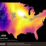
This is a region-specific tool for the contiguous United States, which excludes Hawai'i and Alaska.There are more resources on HerbSpeakAbout BirdCast: Real-Time Migration Forecasts BirdCast is a project of the Cornell Lab of Ornithology that began in 1999 that is...
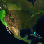
This is a region-specific tool for the United States and its territories. Looking for a global database? Check out KEW, or look for other databases on HerbSpeak’s conservation resources. About the National Wetland Plants List The National Wetland Plants List, or...
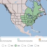
The Plants Database is intended to provide “standardized information about the vascular plants, mosses, liverworts, hornworts, and lichens of the United States and its territories.” for the sake of land conservation across the U.S.
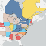
NatureServe Explorer provides an array of data visualizations such as maps, conservation statuses, and technical information on over 100,000 species and ecosystems that are imperiled or at-risk for conservation decision-making.